BP
DIGITAL DOWNLOAD - 1878 Antique Map of Streetsville, Ontario (Southern Part) - Mississauga - Credit River - Toronto Township
DIGITAL DOWNLOAD - 1878 Antique Map of Streetsville, Ontario (Southern Part) - Mississauga - Credit River - Toronto Township
Couldn't load pickup availability
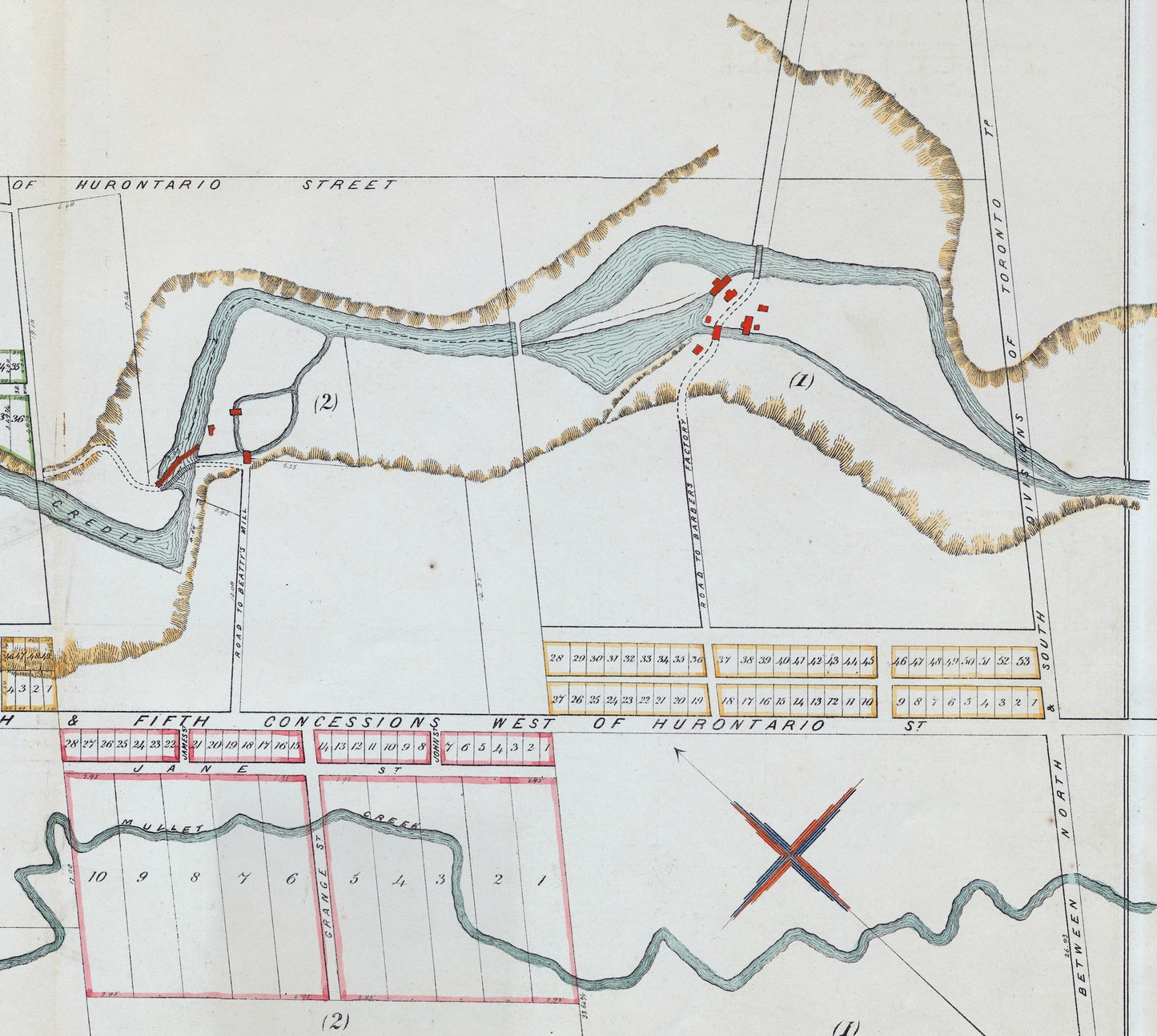
Download this high-resolution JPG image of an antique 1878 map of the southern part of the quaint neighbourhood of Streetsville in Mississauga, Ontario. On upper left, it says "Southern Part of STREETSVILLE, Toronto Township, Scale - 5 chains to 1 inch".
Please note: This is NOT a physical item to be shipped to you. It is a DIGITAL file for downloading. Rather, this scanned image provides an opportunity to get a digital copy of this rare map. (The Digitalstrudel watermark does not appear on the downloaded image.)
The downloadable image (file size: about 14 MB) is 10732 x 6680 pixels, suitable for a high-quality print of approximately 36 inches x 23 inches. Print, mat, and frame -- or use in your collage or artwork.
This image is copyright-free and in the public domain, but please note that we assume no responsibility for the buyer's use of the image for resale or other commercial purposes.
Share