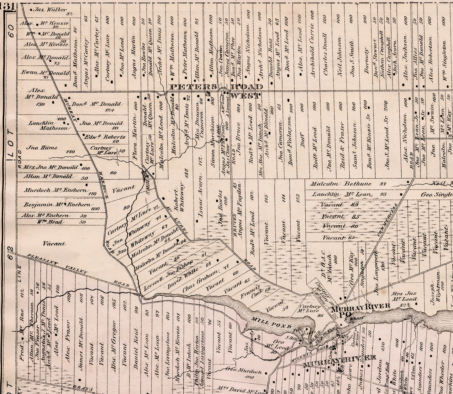
A large antique map of Lots 63 and 64, Kings County, Prince Edward Island. From an atlas printed by J. H. Meacham & Co. in 1880.
Size of map: approx. 27 inches x 16.5 inches. The full map is shown in the last photo. Other photos show details from the map.
This is an original map, not a reproduction! Bananastrudel sells only originals. As shown in the photos, a tear along the left panel of the map has been repaired with tape (by a previous owner).
The names of the owners of the various lots are also shown on the map. If you're looking for specific names in these areas, let us know and we can check if they are listed.